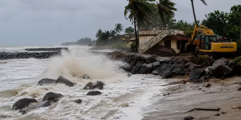
In Ullal, the sea has been advancing at over a metre a year since 1990 — the worst erosion rate anywhere on the Karnataka coast. The story of why starts with two breakwaters built decades apart, and it is still being written today, in a ₹100-crore government allocation sanctioned this May.
A Coastline That Used to Be Somewhere Else
Aloysius Albuquerque Pai has watched the beach in front of his own property change for fifty years. He is the managing director of Summer Sands Beach Resort in Ullal, and in 2014, he lost four villas to the sea. When he traces the story back to its start, he does not point to climate change in the abstract — he points to a specific year and a specific piece of infrastructure: the breakwaters built at the New Mangalore Port project in 1964, which he says triggered erosion on the southern beaches. A second phase of breakwater construction, in 1991–94, at the mouth of the Nethravathi and Phalguni rivers, then brought the same problem directly to Ullal's own shoreline.
That is not one resident's theory. It is broadly consistent with what the science shows. A 2019 peer-reviewed study analysing 26 years of satellite imagery (1990–2016) along the entire Karnataka coast found that Ullal had lost more land to the sea than anywhere else in the state, retreating at a rate of 1.3 metres every year. The same study found erosion at Tannirbhavi, Mukka, Kota and Om beaches too, while noting that a small number of stretches elsewhere on the coast, like Devbagh further north, had actually gained land over the same period. Erosion, in other words, is not happening evenly along the coast — it is concentrated, and much of that concentration traces directly back to how humans have altered the shoreline's natural sediment flow, through ports, breakwaters and seawalls.
The Places Most Affected
The stretch running roughly from Someshwara through Ucchila, Battapady and Ullal to Talapady has borne the brunt of this for over two decades now. Local reporting describes more than 20 houses being lost to the sea in these areas in a typical year, and specific crisis moments have recurred with grim regularity: four villas lost at Ullal in 2014; homes evacuated at Peribail, Kaiko and Someshwara during the 2017 Ockhi cyclone, with named residents receiving emergency housing assistance after losing their homes entirely; and in June 2022, sea erosion cutting off road access to more than 15 houses at Ullal Seaground, with the connecting road to Battapady itself collapsing.
As of a May 2026 statement from the Dakshina Kannada Deputy Commissioner, the district administration considers the stretch from Tannirbhavi toward Battapady and Talapady to be at the highest ongoing risk — and notes explicitly that the erosion of beach sand is now hurting local tourism, not just threatening homes.
Why the Sea Keeps Winning
The scientific consensus, as reflected in the 2019 study, is that Karnataka's coastal erosion results from a combination of human and natural factors: ports, seawalls and breakwaters on one side, and natural longshore drift and seasonal wave patterns on the other. Karnataka is not unique in this — government studies cited in a 2022 Scroll.in investigation found that between a third and 46% of India's entire coastline has eroded to some degree over the last three decades, and more than a fifth of Karnataka's own coast eroded between 1990 and 2016 alone. Separately, researchers have flagged that rising sea levels could put key infrastructure in coastal cities, including Mangalore, at risk of submersion over the longer term — a slower-moving, harder-to-see-year-to-year threat layered on top of the more visible erosion crises.
What makes Ullal's case a particularly clean illustration of the human-caused half of that equation is the timeline Pai and others describe: a stable coastline disrupted first by one piece of port infrastructure in 1964, then by another in the early 1990s, each altering how sand naturally moved along the shore and starving downstream beaches of the sediment that had kept them intact for generations.
Two Decades of Trying to Fix It
The government's response has been long-running, expensive, and only partially successful, by most accounts — including the accounts of the officials who have run it.
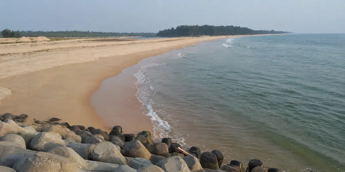
Starting around 2010, the Asian Development Bank-funded Sustainable Coastal Protection and Management Investment Programme (SCPMIP) took up Ullal as its pilot project, with an original estimated cost of roughly ₹223–232 crore. The plan involved four inshore berms, two artificial offshore reefs, and the realignment of two existing breakwaters — engineering interventions specifically designed to correct the sediment-flow disruption caused by the earlier port construction. Fishermen and local residents in Ullal criticised the project even before work began, alleging they had been kept in the dark about its design and that its execution, as they understood it, did not properly account for local wave patterns.
By 2016, officials described the first phase as substantially complete, with two of four inshore berms, one offshore reef and one breakwater finished. But subsequent monsoons kept bringing damage regardless. A ₹155 crore sea wall project followed, built in phases from Kotepura through Subhashnagar and eventually planned to extend from Someshwara to Talapady. The National Institute of Technology Karnataka (NITK), whose own campus sits directly on this coastline at Surathkal, was brought in to recommend seawall construction specifically for the badly affected Batapady stretch. None of this fully solved the problem — locals interviewed in multiple years of reporting have consistently said that dumping boulders and sandbags provides only temporary relief against what they describe as an increasingly aggressive sea.
The most recent chapter is still being written. In May 2026, the Dakshina Kannada Deputy Commissioner announced that ₹100 crore had been sanctioned for each of Karnataka's three coastal districts specifically for permanent coastal protection works, developed with technical guidance from NITK and a Chennai-based engineering agency. And in March 2026, the district administration proposed a genuinely different kind of solution: a 22-kilometre coastal road connecting Ullal to Surathkal, explicitly designed to function as both a high-speed transit corridor and a permanent seawall — integrating erosion protection directly into the road's foundation, rather than building temporary stone barriers that require constant, expensive maintenance. As of that announcement, the project was still awaiting final government clearances, and property analysts were already anticipating rising land values along the route in areas like Mukka and Hosabettu — a reminder that how a city responds to coastal erosion inevitably reshapes its real estate map as well as its coastline.
The Politics Underneath the Waves
A 2022 Scroll.in investigation into Karnataka's eroding coast made an observation worth including here: seawalls, it argued, are politically attractive precisely because they are visible, concrete, photographable symbols of government action — which is not the same thing as saying they are always the most effective long-term solution. Coastal erosion has become, in the piece's framing, a recurring local political issue as much as an engineering one, with each monsoon's damage generating fresh media coverage, fresh ministerial visits, and fresh funding announcements that do not always connect cleanly to the last round of promised fixes. Nothing about the pattern of announcements traced in this piece — 2010, 2014, 2016, 2022, and now 2026 — contradicts that reading.
What Hasn't Changed
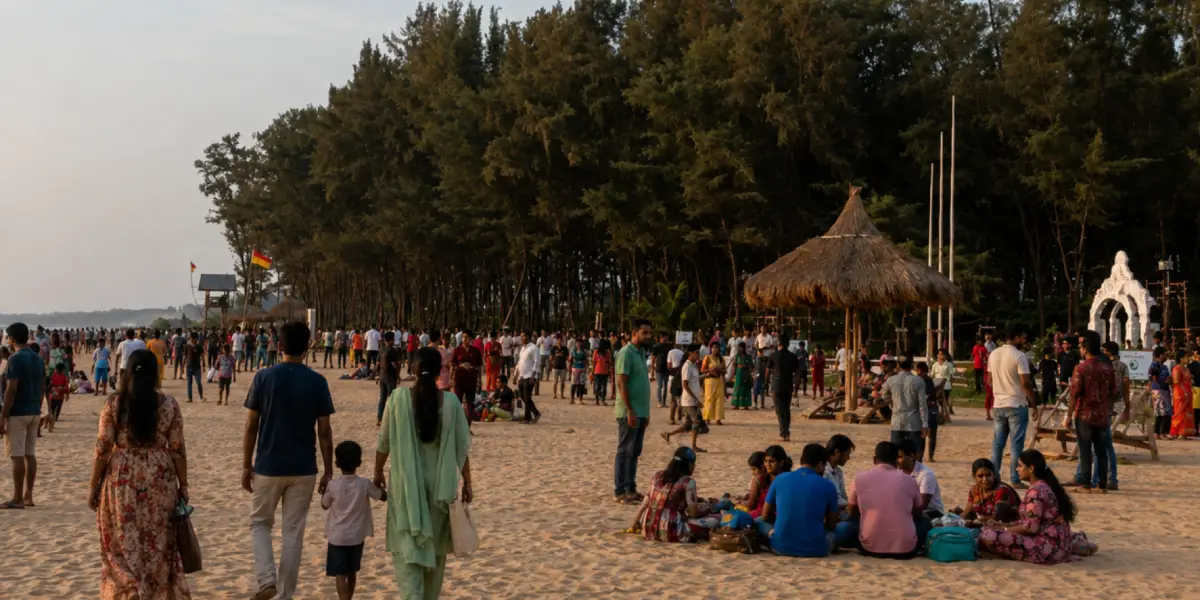
It would be inaccurate to describe Mangaluru's entire coastline as being swallowed by the sea. Tannirbhavi Beach, despite appearing in the 2019 erosion study, remains one of the city's most popular beaches today, second only to Panambur, with functioning tourist infrastructure — lifeguards, toilets, parking, and a nearby barge-mounted power facility that has become a landmark in its own right. Panambur, further from the Ullal-Someshwara-Ucchila-Battapady corridor that has taken the worst of the damage, has not featured in the same pattern of crisis reporting. The story of Mangaluru's changing coast is not one of uniform loss — it is a story of a coastline reshaped unevenly, with some stretches paying a much steeper price than others for infrastructure decisions made decades ago, often kilometres away from where the consequences eventually showed up.
The Takeaway
The coast that people who grew up in Mangaluru remember was never going to stay exactly the same — coastlines never do. But the specific shape of what changed here is not simply a story about climate change in the abstract, however real that longer-term threat is. It is, in large part, a traceable story about two rounds of port and breakwater construction, decades apart, and a government response that has spent well over ₹500 crore across more than fifteen years trying to correct a problem that engineering decisions helped create in the first place — with the most ambitious attempt yet, a 22-kilometre road built to double as a sea wall, still on the drawing board as of this year. Whether that finally holds the line is, quite literally, still being decided.


0 Comments
Leave a Comment